13943 E Lupine Ave, Scottsdale, AZ 85259
Found as: 13943, East Lupine Avenue, Scottsdale, Maricopa County, Arizona, 85259, United States. Measured Oct 5, 10:05 PM PT from LiDAR flown 2020-11-28, 26.76 points per m². Dataset usgs:AZ_MaricopaPinal_1_2020.
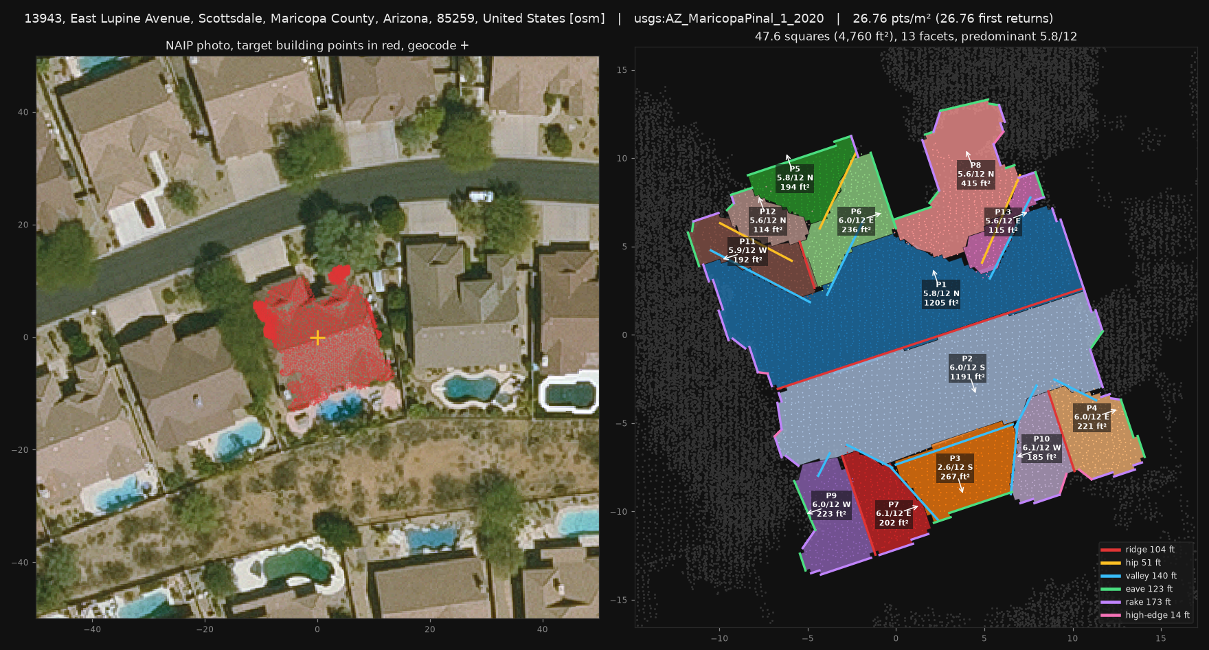
Left: aerial photo with the building's LiDAR points in red; check it picked the right house. Right: each plane coloured with its pitch, facing and area; lines are ridges (red), hips (amber), valleys (blue), eaves (green), rakes (purple).
Planes
| Plane | Pitch | Degrees | Faces | Area ft² |
|---|---|---|---|---|
| P1 | 5.8/12 | 25.9° | N (342°) | 1,205 |
| P2 | 6.0/12 | 26.6° | S (162°) | 1,191 |
| P3 | 2.6/12 | 12.3° | S (163°) | 267 |
| P4 | 6.0/12 | 26.4° | E (72°) | 221 |
| P5 | 5.8/12 | 25.9° | N (341°) | 194 |
| P6 | 6.0/12 | 26.7° | E (72°) | 236 |
| P7 | 6.1/12 | 26.8° | E (71°) | 202 |
| P8 | 5.6/12 | 24.8° | N (338°) | 415 |
| P9 | 6.0/12 | 26.5° | W (252°) | 223 |
| P10 | 6.1/12 | 26.9° | W (252°) | 185 |
| P11 | 5.9/12 | 26.3° | W (253°) | 192 |
| P12 | 5.6/12 | 25.2° | N (340°) | 114 |
| P13 | 5.6/12 | 24.9° | E (69°) | 115 |
Edges and lines
| Ridge | Hip | Valley | Rake | Eave | Wall or high edge |
|---|---|---|---|---|---|
| 104 ft | 51 ft | 140 ft | 173 ft | 123 ft | 14 ft |
Line lengths are the weakest part of this beta and usually come out short; areas and pitch are the strongest. Detached garages and sheds are not included.
Is this right?
Tell us what is wrong or what you would want here: a different total, a missed plane, the wrong house, a pitch you measured on site. Real numbers from jobs you know help most.